 Stefan Freelan Cartography
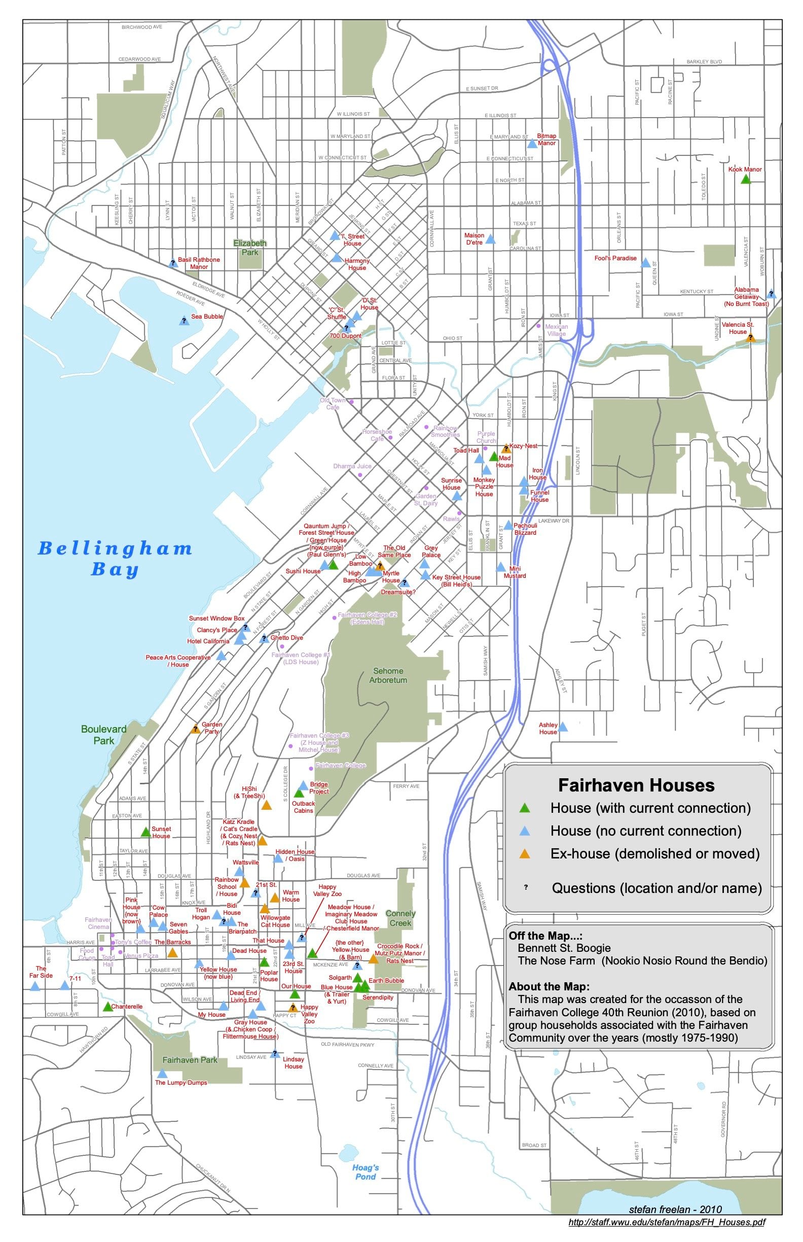
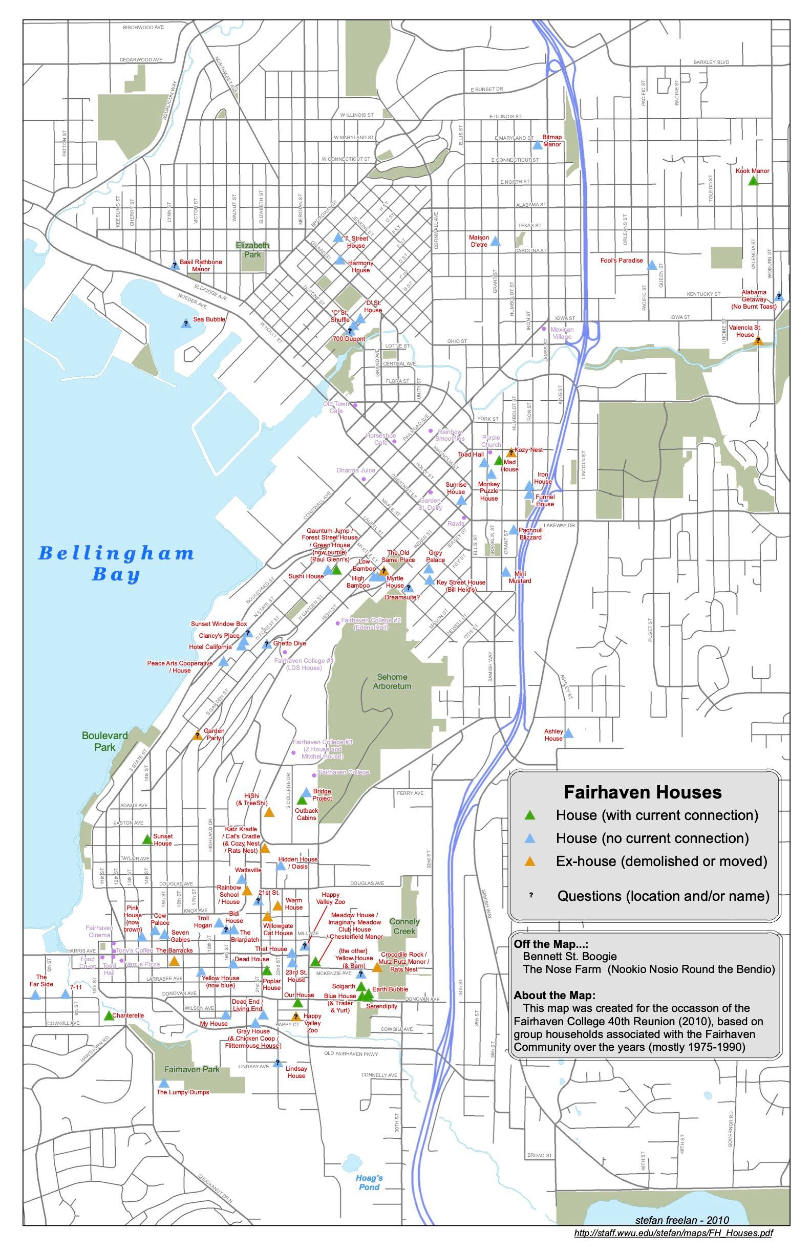
Fairhaven College Households (Circa 1975-1990)
- 2010
- 11x17
Other downloads
Cite this map
Freelan, Stefan. 2010. Fairhaven College Households (Circa 1975-1990). Map, 11x17 in. Vashon, WA: Stefan Freelan Cartography. https://stefanfreelan.com/maps/fairhaven-college-households.