Static Maps
To view / download / print individual maps (including geo-enabled pdfs) see links below the gallery

Dunn Gardens, Seattle (2019) - 8.5x11
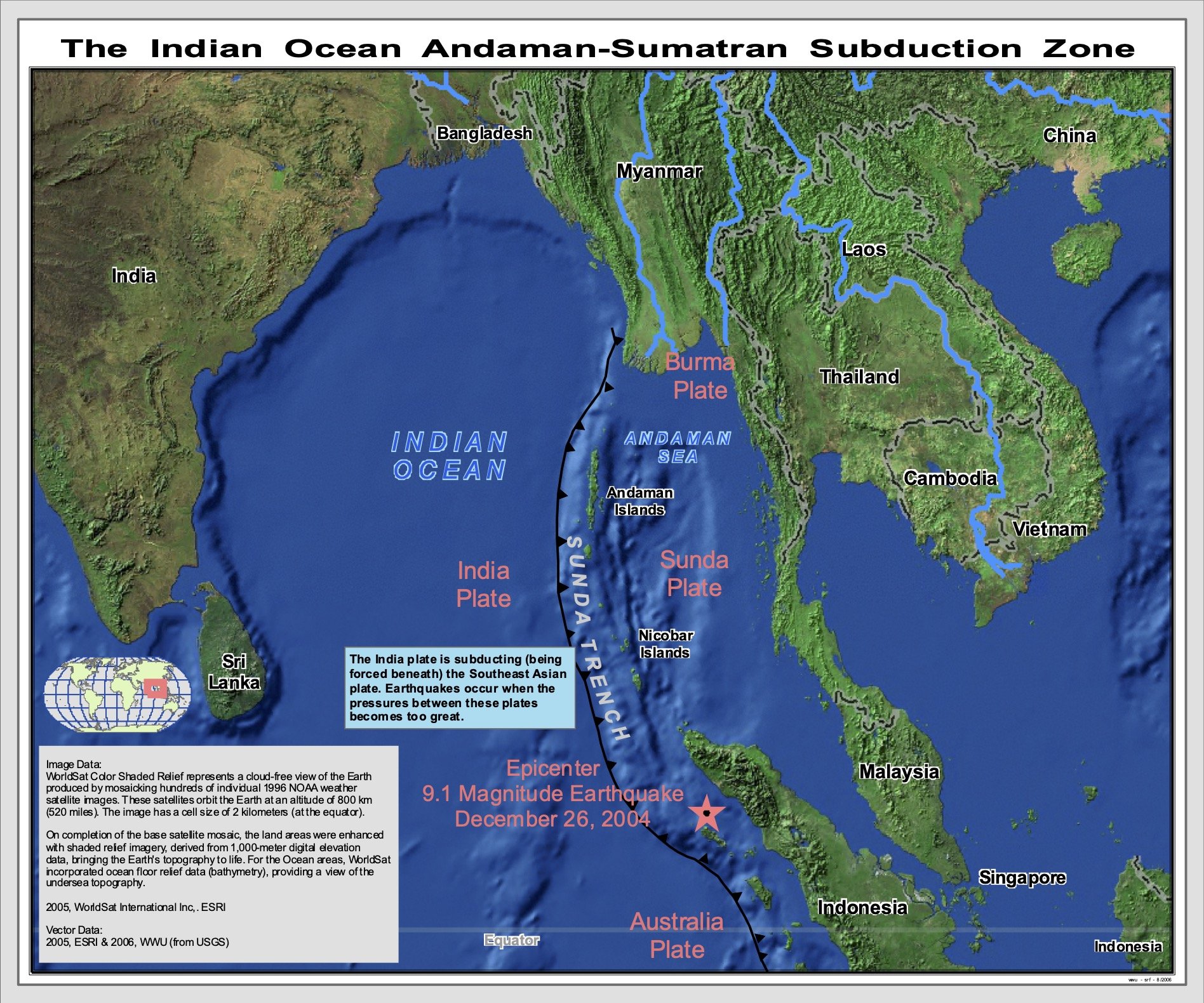
2004 Indian Ocean Tsunami (2006)

The San Juan Islands (1850’s) - 8.5x11

Wedding Map (2014)

Major Watershed / Continental Divides of North America (2021) - 8.5x11

Sucia Bathymetry, 2009 - 8.5x11

Half of the Population of Canada Lives South of the Red Line (46° N) (2021) - 8.5x11

Countries That DO NOT Use the Metric System… (2020) - 8.5x14
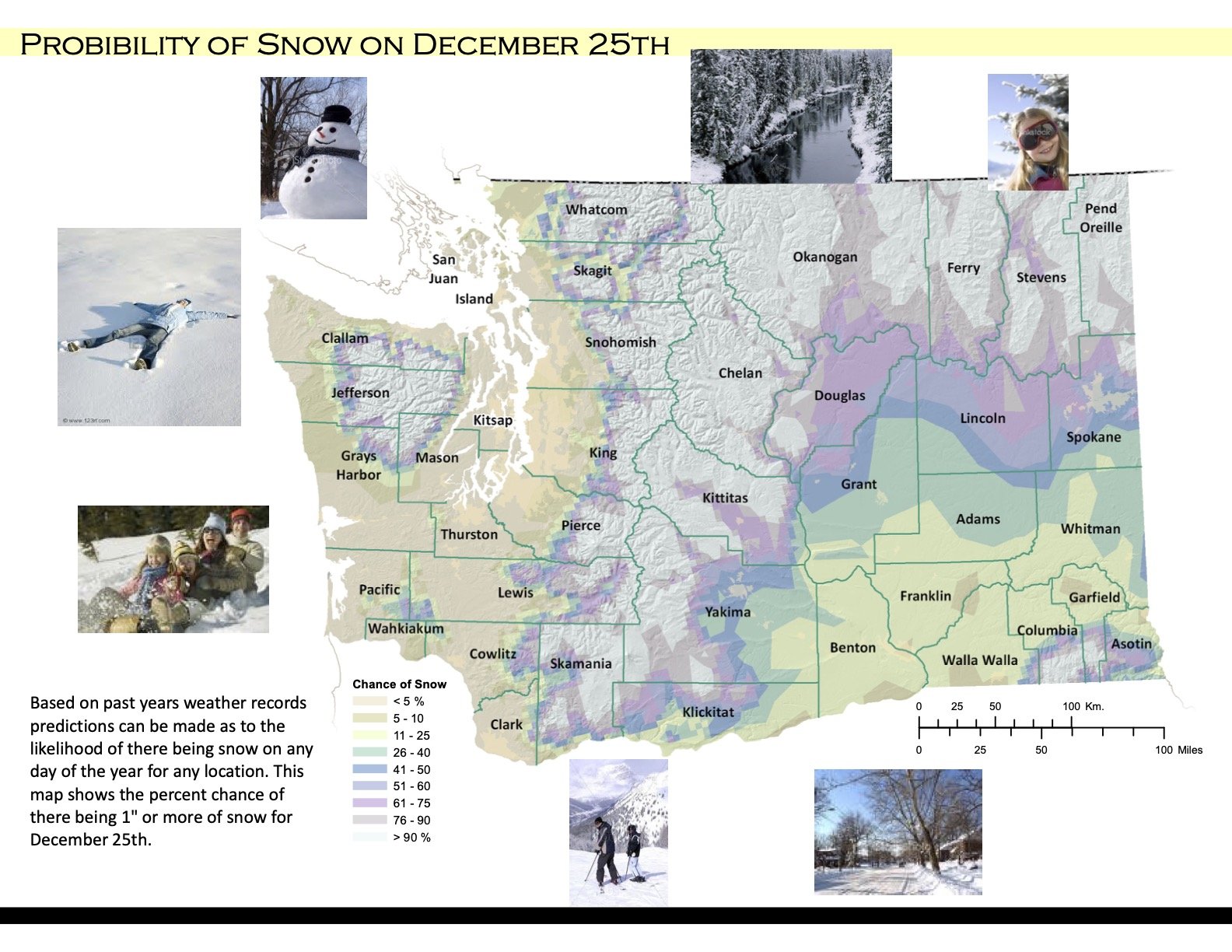
Probability of Snow on December 25th in Washington (2011) - 8.5x11
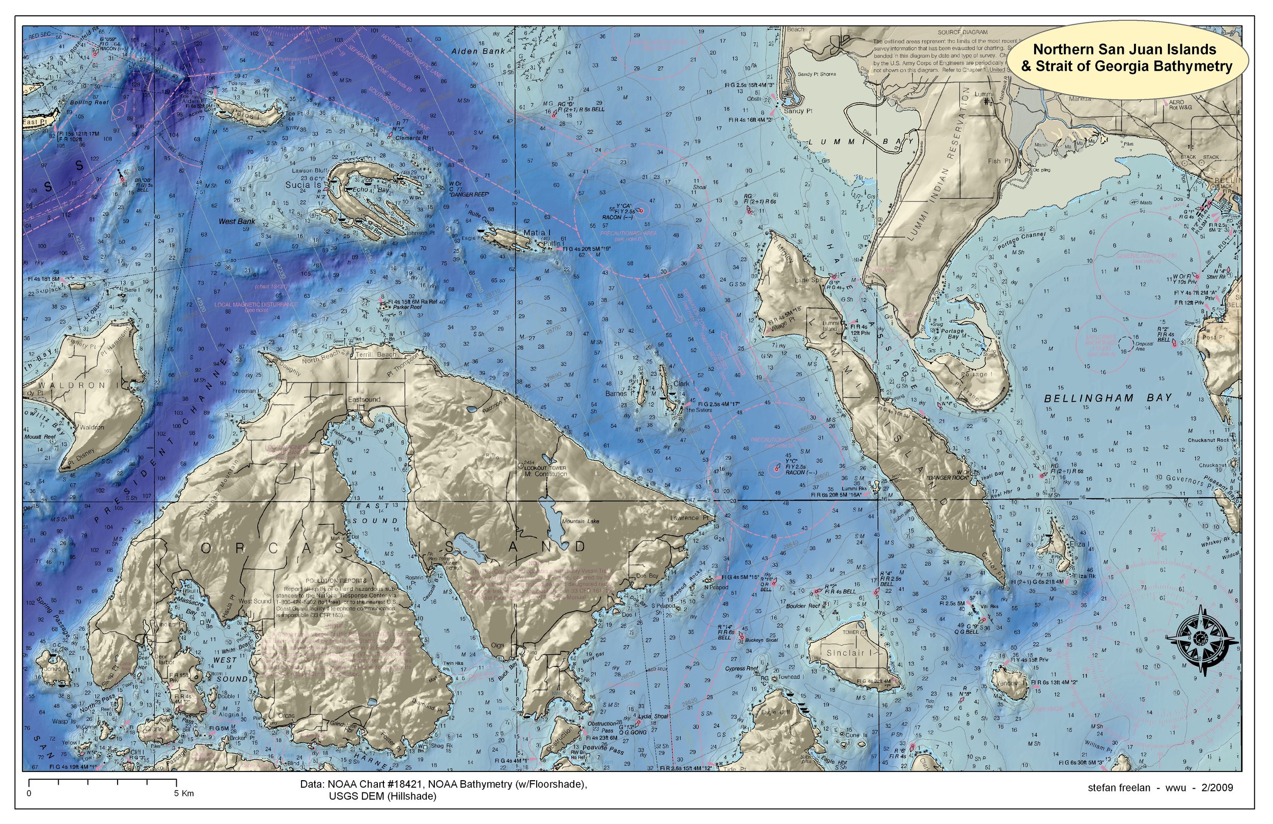
Northern San Juan Islands Bathymetry, 2009 - 11x17

States with a Smaller Population than LA County (2020) (2021) - 8.5x11

Fairhaven College Households (Circa 1975-1990) (2010) - 11x17
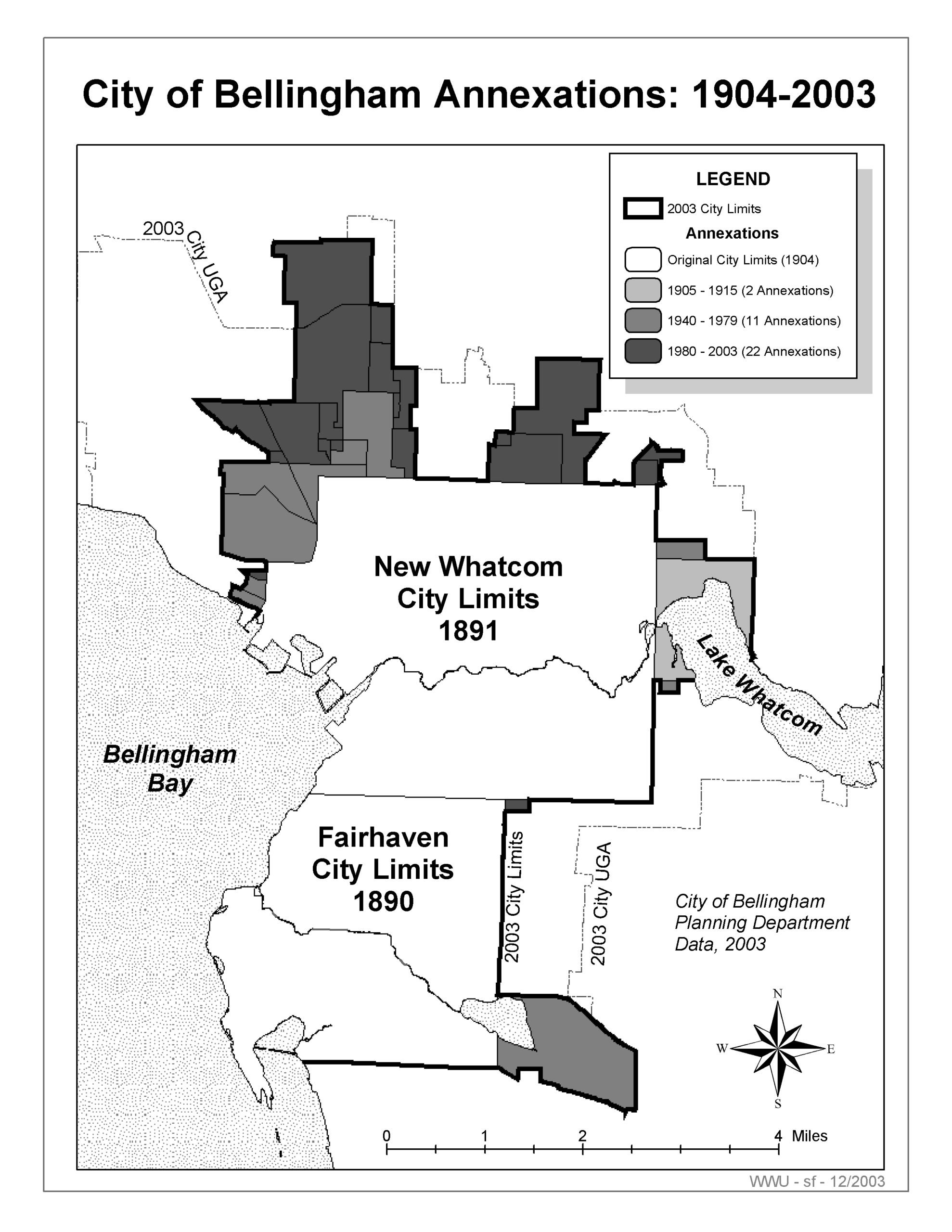
City of Bellingham Annexations (1904-2003) (2003) - 8.5x11

WA and OR Territories (1848-1864) (2011) - 8.5x11

Map of the Salish Sea & Surrounding Basin (2023) - 11x17
Geo-Enabled Static Maps
.
A geo-enabled PDF file is a static map that contains coordinate information (latitude-longitude). Geo-PDF’s can be used with Avenza Maps (or other geo-PDF apps). The Avenza app connects a geo-PDF map with the GPS device in a phone or tablet for navigation or data collection in the field and can be used offline (i.e., without phone or data connectivity). Once downloaded to your mobile device, using a geo-enabled PDF file does not consume data bandwidth or costs.
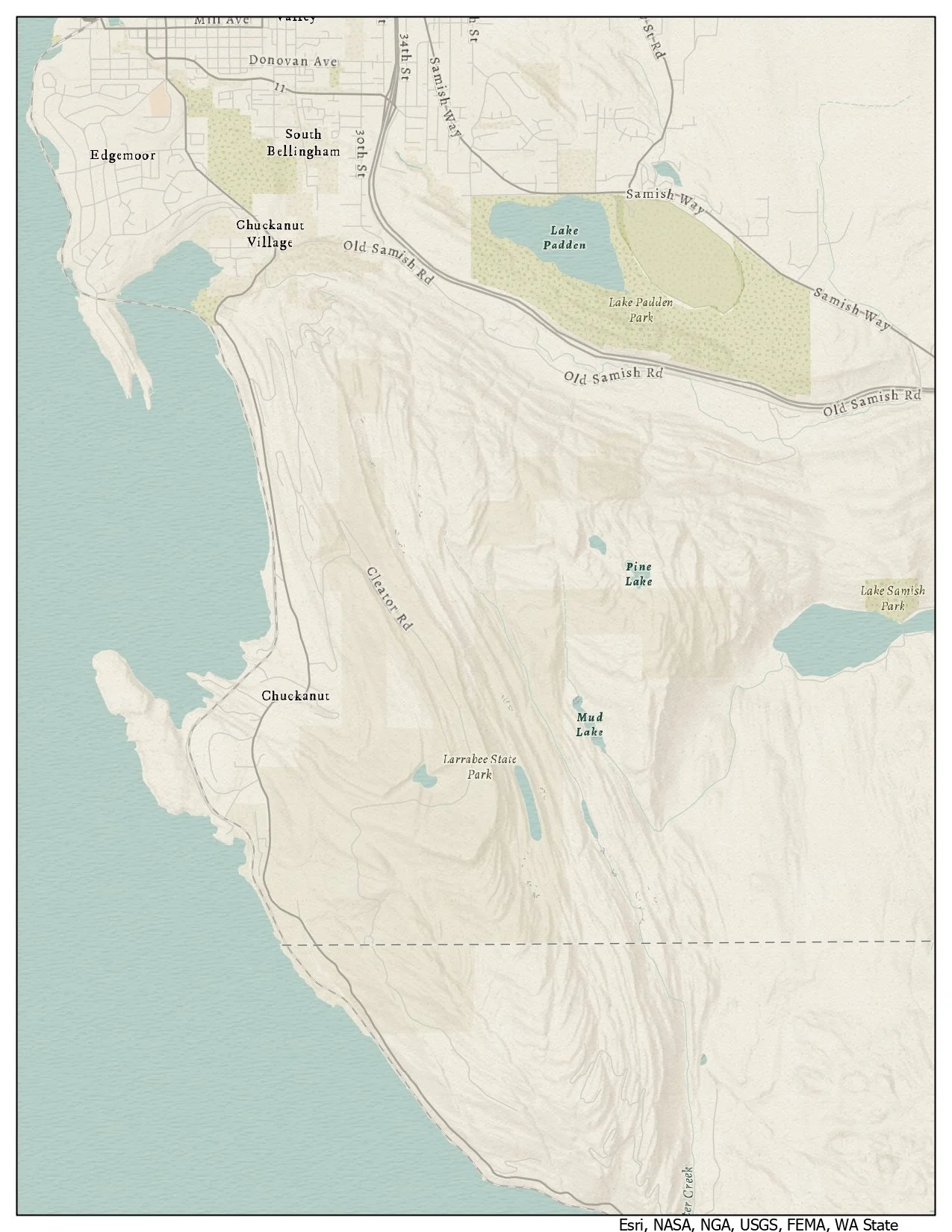
Chuckanut Mountains
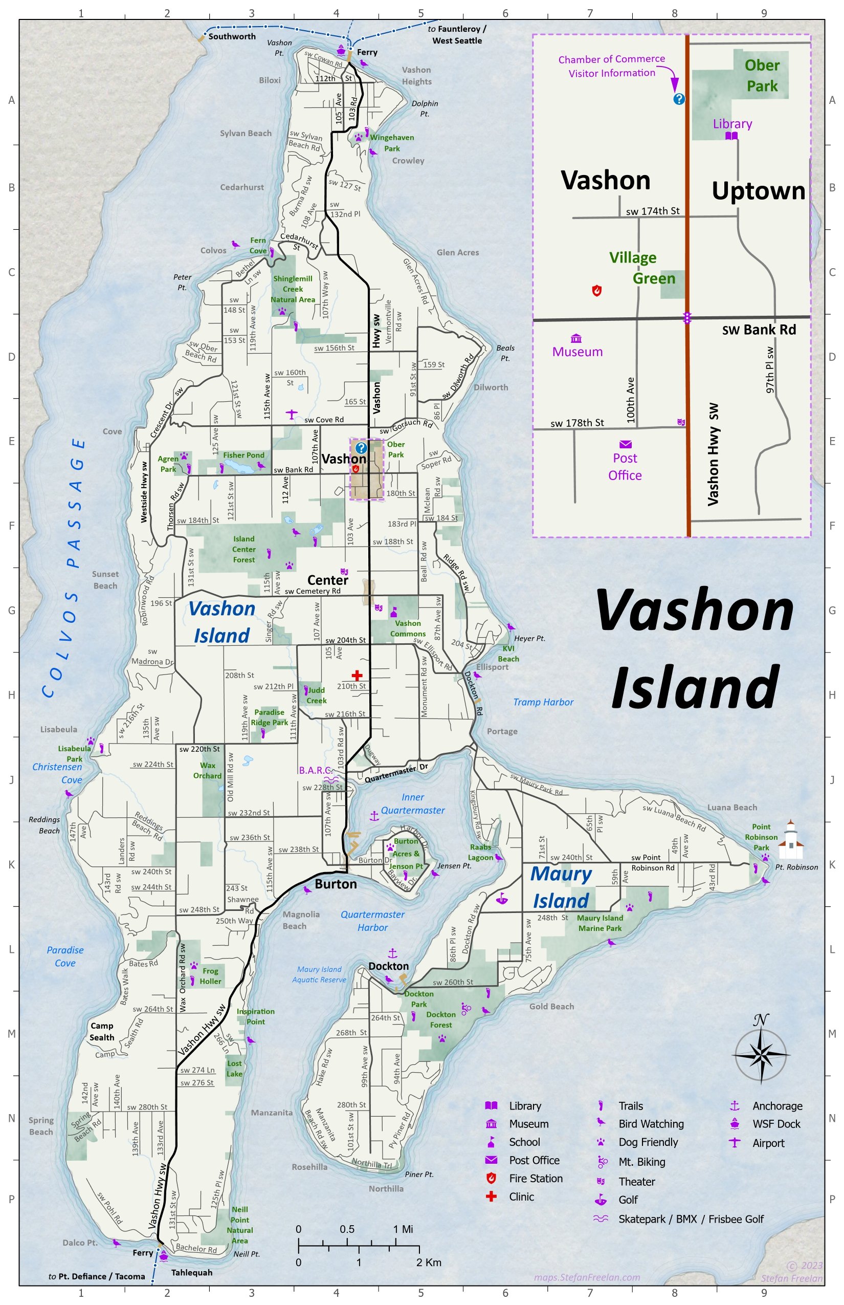
Vashon Island, 2023

Vashon Adventures, Bicycle Camping, Vashon Island, 2024
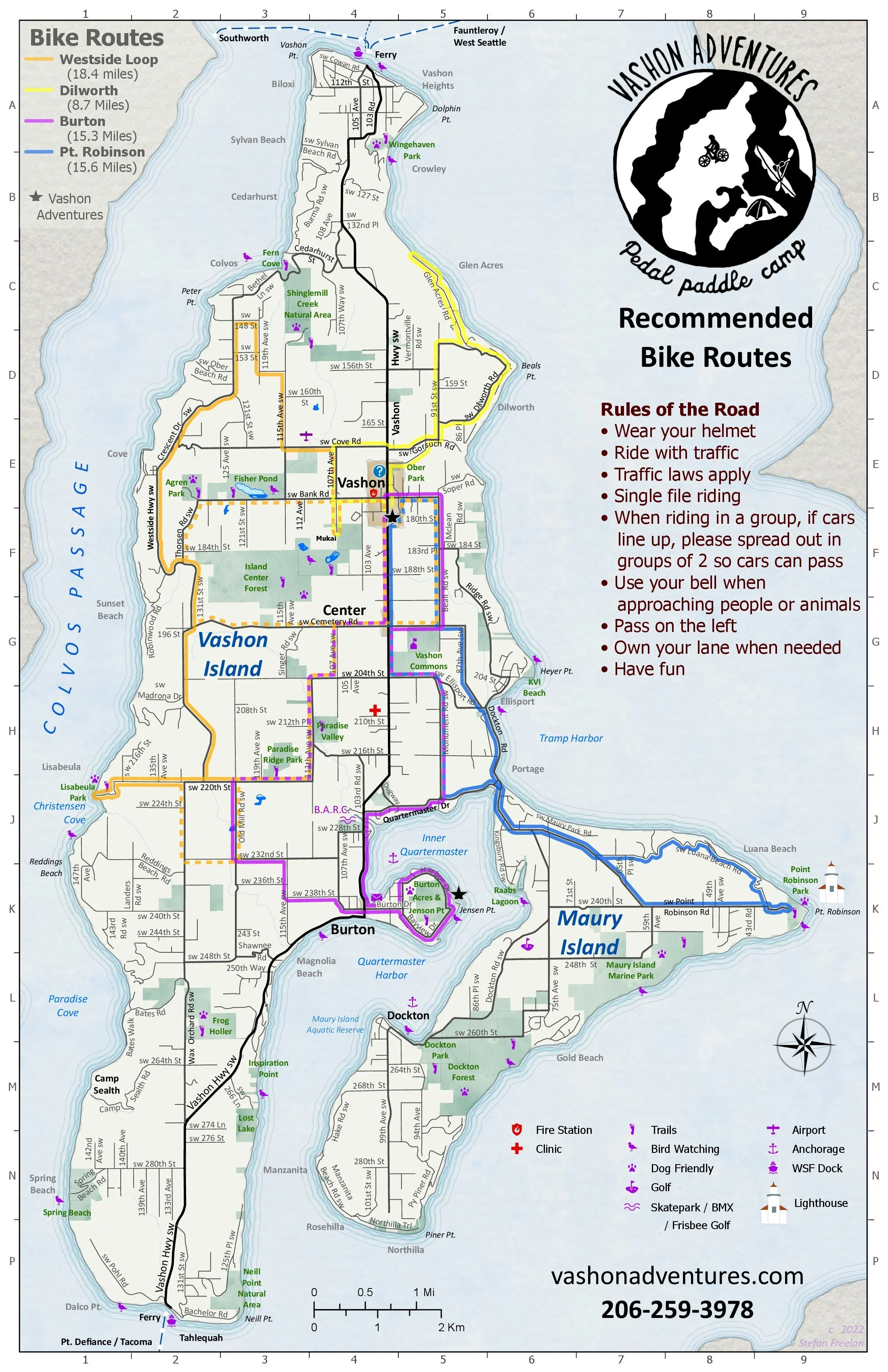
Vashon Adventures, Bike Routes, Vashon Island, 2023

Vashon Island Chamber of Commerce Businesses (2023)

Mt. Baker Ski Area
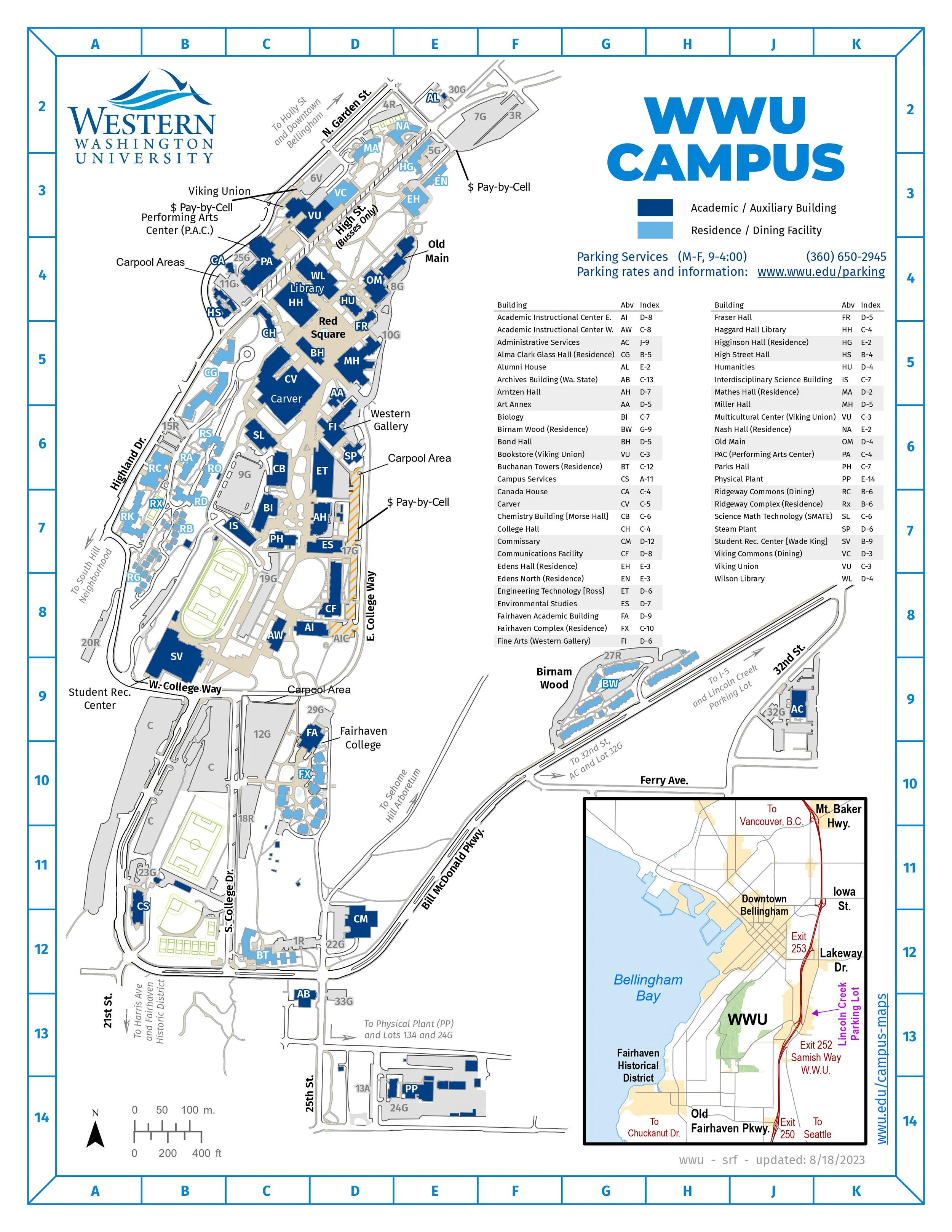
WWU Campus Map, 2023
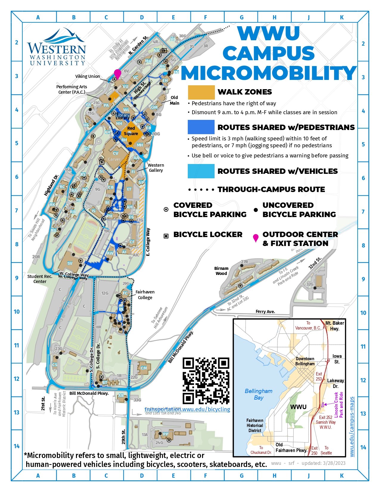
WWU Bike Map, 2023
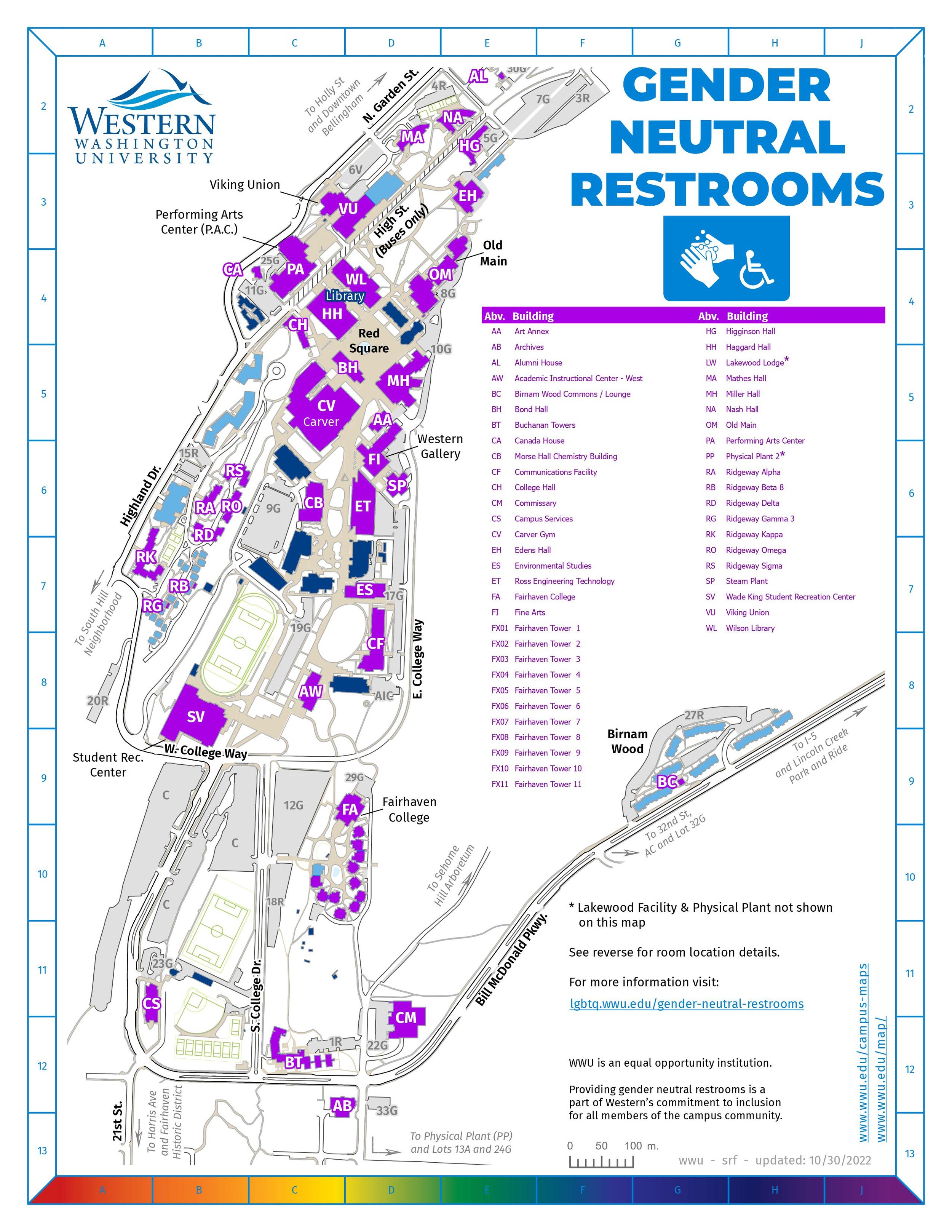
WWU Gender Neutral Restrooms, 2023
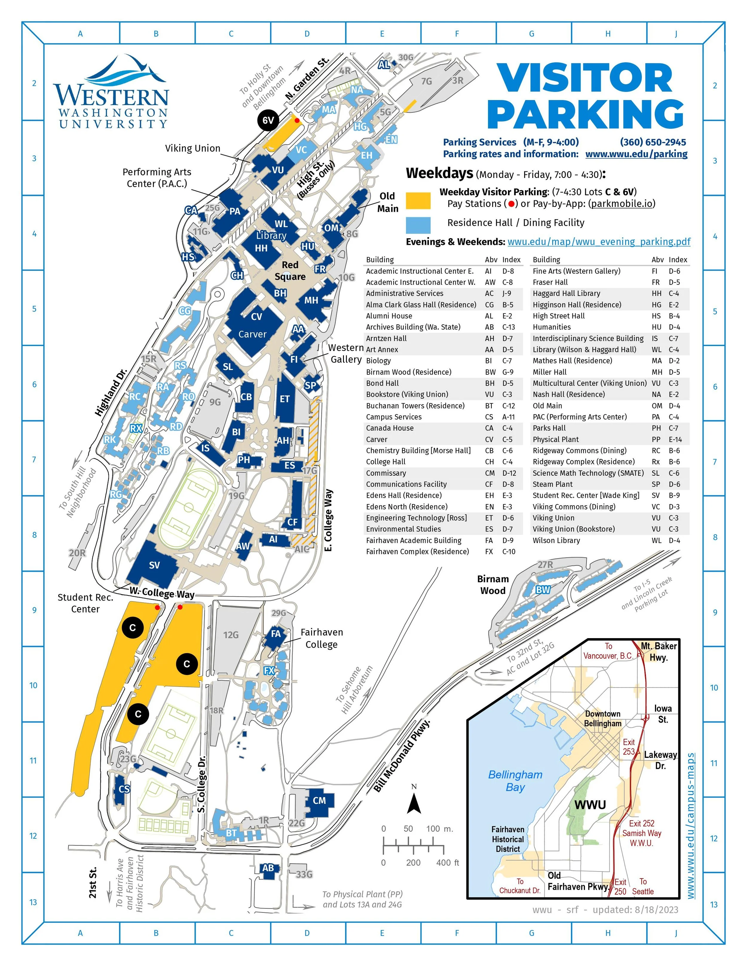
WWU Visitors Parking, 2023